
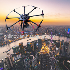
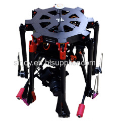
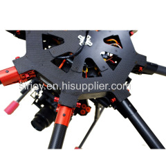
Aerial survey uav mapping drone with camera and GPS
| Min. Order: | 1 Set/Sets |
|---|---|
| Trade Term: | FOB |
| Payment Terms: | Paypal, L/C, T/T, WU, Money Gram |
| Supply Ability: | 10000 sets / year |
| Place of Origin: | Sichuan |
Company Profile
| Location: | Chengdu, Sichuan, China (Mainland) |
|---|---|
| Business Type: | Trading Company |
Product Detail
| Means of Transport: | Ocean |
|---|---|
| Production Capacity: | 10000 sets / year |
| Packing: | air cargo case |
| Delivery Date: | 10 days |
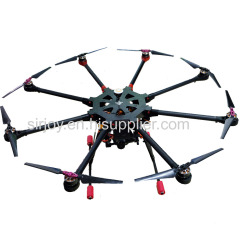
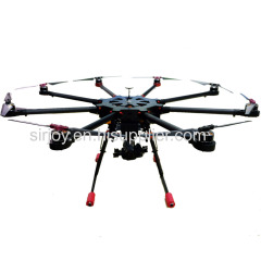
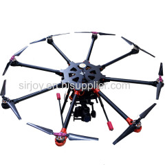
Product Description
Size (open): L2662.5px*W2662.5px*H1125px
Equipped with drone self-stabilizing system: Yes
Equipped with intelligent control pesticide system: Yes
Equipped with runaway safeguard: Yes
Equipped with GPS system: Yes
Max Flying Speed: 100 km/h
Endurance time with load: 18 mins
Suspension stop at anytime: Yes
Flying height: 1km
Frame lifetime: More than 5 years
Wind loading rate: Level 6
This drone is widely used to map terrain, aerial photo,inspection of power cables, police spy and so on.
Advantage:
1. Light and small design for drone, used to carry precise instrument, more accurate when working.
2. When tasking, no limitation for terrain, even in the district of high altitude, the drone also have good performance;
3. Easy to operate, high efficiency;
4. Powered by chargeable Lithium-ion battery, typically last for 200-300 times, chargeable, which does good to protect environment;
5. The drone is demountable, convenient for renewal of components, reduce maintain cost to the maximum;
6. Equipped with sealing motor, dustproof and waterproof;
7.Lifelong after-sale, more professional.