
2018 Best Drone Surveying UAV Mapping Drone Powerline Monitoring UAV Drone
| Min. Order: | 1 Set/Sets |
|---|---|
| Trade Term: | FOB |
| Payment Terms: | L/C, T/T |
| Supply Ability: | 1000sets/year |
| Place of Origin: | Liaoning |
Company Profile
| Location: | Dalian, Liaoning, China (Mainland) |
|---|---|
| Business Type: | Manufacturer, Trading Company |
Product Detail
| Model No.: | hawk-eagle-01 |
|---|---|
| Means of Transport: | Ocean, Air, Land |
| Brand Name: | Hongyi |
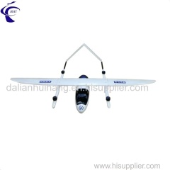
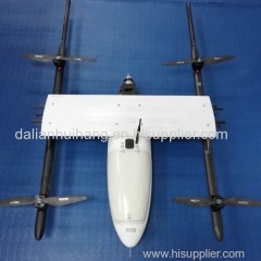
| Product name: | 2018 Long Range Autopilot Mapping Fixed Wing Helicopter UAV Drone |
| Color: | silver grey |
| Control system: | VTOL Autopilot |
| Payload: | 2KG |
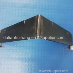
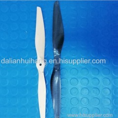
| Material: | composite material |
| Flight duration: | 90min |
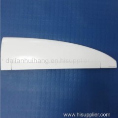
| Wing Span: | 2400mm |
| Length: | 1470mm |
| Flight Radius: | 40km |
| Cruising Speed: | 90Km/h |
| Production Capacity: | 1000sets/year |
| Packing: | aluminium case |
| Delivery Date: | in 4 weeks after order confirmaiton |
Product Description
HAWK-EAGEL-01 is specialized developed for mapping and surveying application. It is equipped with multispectral, hyperspectral or thermal camera to serve different services. If image live feeding required it can also be fitted with image transmission device. It is a long range drone, which can continue to fly 2 hours, while its operation duration will reach 90 minutes with effective payload. Its flight radius under monitor of ground station reaches over 80KM.
Its fuselage is made of composite material with high strength &good aerodynamic effect. Its body parts can be detached, which makes maintenance convenient It is a VTOL type drone. Autonomous take off, hovering, flight and landing can be achieved by one button push through hand-held ground station. The optional RTK position will help to realize fixed landing and more precise operation. It is designed to stand 5 degree wind and ensure aerial shooting and survey clear with a stable and reliable flight.
If you are trying to find a mapping or surveying drone our HAWK-EAGLE-01 will be a better choice with more competitive price.