
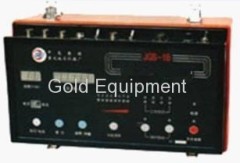
Geophysical Logger Water Well Exploration Probe System
| Min. Order: | 1 Set/Sets |
|---|---|
| Payment Terms: | L/C, T/T, WU |
| Supply Ability: | 100unit/month |
| Place of Origin: | Chongqing |
Company Profile
| Location: | Chongqing, China (Mainland) |
|---|---|
| Business Type: | Manufacturer |
| Main Products: | Geological Prospecting Equipment, Drilling Machine |
Product Detail
| Means of Transport: | Ocean, Air, Land |
|---|---|
| Brand Name: | Gold |
| Production Capacity: | 100unit/month |
| Packing: | export case |
| Delivery Date: | 10 days |
Product Description
Geophysical Logger Water Well Exploration Probe System
Main Applications and Features
1 Coal Field Digital Integrated Logging
2 Hydrological Engineering Digital Integrated Logging
3 Solid Metal Ore Digital Integrated Logging
4 Other Minerals Digital Integrated Logging
5 External Laptop (Desktop PC)
6 For upward logging, also for downward logging
7 Receive digital signal, analog signal
8 8 taps of power supply current, Optional
9 Automatic sampling as per depth interval, sampling interval arbitrarily
10 Indoor simulation logging, repeatability observation of instruments and probes
11 Membrane panel, attractive and durable.
Technical Specifications
1 12bit A/D Conversion, Program-Controlled Magnification K=0.5~128
2 Counting Channel: f≤500KHz
3 Digital Signal Transmission Frequency: 9600bit/s
4 Power Supply Cycle: 400ms
5 Current: 2mA~500 mA Optional
6 Signal Input Range: ≤±10V
7 Continuous Working Time: ≤24 hr
8 Power Consumption: <200W
9 Volume: 420×260×210mm,
10 Weight: <7Kg
11 Working Temperature Range: -10°C~ +50°C
12 Working Power Supply: AC220V±10% 50Hz ±5%
13 Logging Speed: 0~30 m/min Adjustable (as per sampling interval)
Logging Working Software System
1 12bit A/D Conversion, Program-Controlled Magnification
2 Operation Environment: Windows98/2000/XP
3 Sampling Interval: Arbitrary (1~1000cm)
Setting (1cm, 2cm, ...1000cm)
4 Maximum depth of one-time acquisition: 3000m (0.1m sampling interval)
5 Depth automatic alignment of multi-parameters
6 Superposition of multi-parameters up to 10
7 Curve movement, anomaly removal, smoothing, inverted order, , segmentation, calculation, etc.
8 Interpretation of profile input, automatic generation of rock stratum name, thickness and baseplate depth
9 Curve amplification and compression
10 5 types of curve depth ratio: 1:50, 1:100, 1:200, 1:500, 1:1000
11 Continuous drawing production in color or black-and-white effects
12 Output graph maximum width: 415mm, length: 2310mm